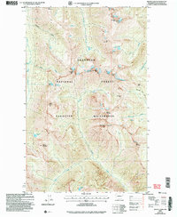
2002 Map of Mount Lago
USGS Topo · Published 2006About this map
Mount Lago stands as a central landmark within this high-elevation landscape of the Okanogan National Forest, where steep ridgelines and alpine basins define the northern Cascades terrain. This 2002 revision by the Forest Service highlights a network of dramatic summits including Ptarmigan Peak, Osceola Peak, and Blackcap Mountain. The hydrology of the Pasayten Wilderness is documented through the headwaters of Eureka Creek and Ptarmigan Creek, which drain a series of high-mountain basins containing Lake Doris, Ferguson Lake, and the Dot Lakes. The presence of the Monument Creek Trail and various named passes like Shellrock Pass and Butte Pass indicates the established routes used by backcountry travelers and forest rangers throughout the late 20th century. The map provides a detailed record of glacial features and drainage patterns, such as the Middle Fork Pasayten R and Lease Creek, within one of the most protected wilderness areas in the state.
Find a feature on this map
32 named features on this map. Tap any name to fly to it.
Don’t see what you’re looking for? This feature index may not catch every label — zoom into the map to look around manually.
Map Details
Editions of this 2002 Mount Lago Map
This is the sole edition of this map. No revisions or reprints were ever made.
Other maps of this area

1920 · Slate Pass
USGS Topo · 1:125,000

1955 · Concrete
USGS Topo · 1:250,000

1958 · Concrete
USGS Topo · 1:250,000

1962 · Concrete
USGS Topo · 1:250,000

1962 · Mazama
USGS Topo · 1:62,500

1963 · Slate Peak
USGS Topo · 1:24,000
1963 · Robinson Mtn.
USGS Topo · 1:24,000

1969 · Frosty Creek
USGS Topo · 1:24,000

1969 · Lost Peak
USGS Topo · 1:24,000
1969 · Pasayten Peak
USGS Topo · 1:24,000