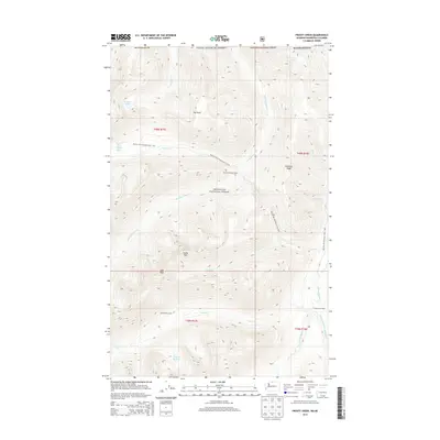
2014 Map of Frosty Creek
USGS Topo · Published 2014About this map
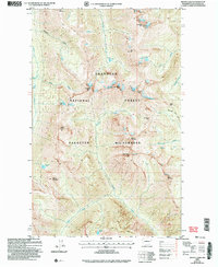
Okanogan National Forest defines this high-elevation landscape along the Canadian border, where the Pacific NW National Scenic Trail traverses a series of dramatic ridges and drainages. The map details a network of remote outposts and seasonal sites including Chuchuwanteen Cabin and Brown Bear Camp, which served as critical points for forestry and wilderness management. High mountain waters are prominent throughout the quadrangle, from the headwaters of Chuchuwanteen Cr to Heather Lake and the Lake of the Pines. Significant terrain features like Soda Peak and Holdover Ridge provide a clear view of the complex topography leading toward the Pasayten River valley. The presence of Three Forks Cabin near the confluence of the river's forks illustrates the established backcountry infrastructure utilized by generations of rangers and hikers in this corner of Washington.
Find a feature on this map
34 named features on this map. Tap any name to fly to it.
Don’t see what you’re looking for? This feature index may not catch every label — zoom into the map to look around manually.
Map Details
Editions of this 2014 Frosty Creek Map
This is the sole edition of this map. No revisions or reprints were ever made.
Other maps of this area

1920 · Slate Pass
USGS Topo · 1:125,000

1955 · Concrete
USGS Topo · 1:250,000

1958 · Concrete
USGS Topo · 1:250,000

1962 · Concrete
USGS Topo · 1:250,000

1969 · Frosty Creek
USGS Topo · 1:24,000
1969 · Pasayten Peak
USGS Topo · 1:24,000

1969 · Tatoosh Buttes
USGS Topo · 1:24,000
1969 · Shull Mtn.
USGS Topo · 1:24,000
1969 · Mount Lago
USGS Topo · 1:24,000
2002 · Mount Lago
USGS Topo · 1:24,000