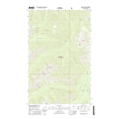
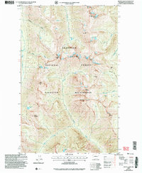
2017 Map of Frosty Creek
USGS Topo · Published 2017About this map
Okanogan National Forest dominates this high-altitude landscape where the headwaters of the Pasayten River system begin their descent. The terrain is characterized by massive crests like Buckskin Ridge and Holdover Ridge, and prominent summits including Smoky Mtn and Soda Peak. Water is a defining element of the geography, from the alpine stillness of Heather Lake and Frosty Lake to the drainage networks of Rock Creek and Chuchuwanteen Cr.
Find a feature on this map
41 named features on this map. Tap any name to fly to it.
Don’t see what you’re looking for? This feature index may not catch every label — zoom into the map to look around manually.
Map Details
Editions of this 2017 Frosty Creek Map
This is the sole edition of this map. No revisions or reprints were ever made.
Other maps of this area

1920 · Slate Pass
USGS Topo · 1:125,000

1955 · Concrete
USGS Topo · 1:250,000

1958 · Concrete
USGS Topo · 1:250,000

1962 · Concrete
USGS Topo · 1:250,000

1969 · Frosty Creek
USGS Topo · 1:24,000
1969 · Pasayten Peak
USGS Topo · 1:24,000

1969 · Tatoosh Buttes
USGS Topo · 1:24,000
1969 · Shull Mtn.
USGS Topo · 1:24,000
1969 · Mount Lago
USGS Topo · 1:24,000
2002 · Mount Lago
USGS Topo · 1:24,000