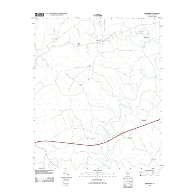
2011 Map of Fruithurst
USGS Topo · Published 2011About this map
Fruithurst and Muscadine serve as the primary hubs in this eastern Alabama landscape, where the Tallapoosa River winds through the central and southern reaches. The region's history is preserved in several rural burial grounds, including the Upper Cane Creek Cemetery near the northern border and the Ai Cemetery located south of the river. These sites, along with the Mount Olive Cemetery, provide essential points of reference for genealogists tracking family origins in Cleburne County.
Find a feature on this map
81 named features on this map. Tap any name to fly to it.
Don’t see what you’re looking for? This feature index may not catch every label — zoom into the map to look around manually.
Map Details
Editions of this 2011 Fruithurst Map
This is the sole edition of this map. No revisions or reprints were ever made.
Other maps of this area

1889 · Tallapoosa
USGS Topo · 1:125,000

1892 · Tallapoosa
USGS Topo · 1:125,000

1897 · Tallapoosa
USGS Topo · 1:125,000

1900 · Anniston
USGS Topo · 1:125,000

1953 · Atlanta
USGS Topo · 1:250,000

1957 · Atlanta
USGS Topo · 1:250,000

1958 · Atlanta
USGS Topo · 1:250,000

1965 · Tallapoosa South
USGS Topo · 1:24,000

1966 · Tallapoosa North
USGS Topo · 1:24,000
1966 · Hightower
USGS Topo · 1:24,000