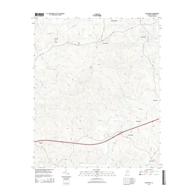
2014 Map of Fruithurst
USGS Topo · Published 2014About this map
Fruithurst and the surrounding Cleburne County countryside are defined by a network of rural roads and historical landmarks that trace the settlement patterns of northeastern Alabama. The landscape is dotted with ancestral sites such as Upper Cane Creek Cem, Harmony Grove Cem, and Mt Olive Cem, providing critical touchpoints for genealogical research. The Tallapoosa River winds through the southern portion of the area, while smaller waterways like Cane Cr and Muscadine Creek carve through the terrain. Evidence of older transit routes persists in the form of the Old Georgia Rd, which runs north of the modern corridor. From the community of Ai to the larger hubs of Heflin and Edwardsville, this survey documents the persistent rural character of the region, including notable landforms like Mains Gap and local water bodies such as Laminack Lake.
Find a feature on this map
83 named features on this map. Tap any name to fly to it.
Don’t see what you’re looking for? This feature index may not catch every label — zoom into the map to look around manually.
Map Details
Editions of this 2014 Fruithurst Map
This is the sole edition of this map. No revisions or reprints were ever made.
Other maps of this area

1889 · Tallapoosa
USGS Topo · 1:125,000

1892 · Tallapoosa
USGS Topo · 1:125,000

1897 · Tallapoosa
USGS Topo · 1:125,000

1900 · Anniston
USGS Topo · 1:125,000

1953 · Atlanta
USGS Topo · 1:250,000

1957 · Atlanta
USGS Topo · 1:250,000

1958 · Atlanta
USGS Topo · 1:250,000

1965 · Tallapoosa South
USGS Topo · 1:24,000

1966 · Tallapoosa North
USGS Topo · 1:24,000
1966 · Hightower
USGS Topo · 1:24,000