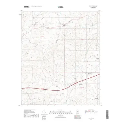
2018 Map of Fruithurst
USGS Topo · Published 2018About this map
The Tallapoosa River snakes through the southern portion of this Cleburne County landscape, defining the topography of the Alabama Piedmont. This area of eastern Alabama is characterized by small, dispersed communities linked by a dense network of county roads like Old Georgia Rd. The settlement pattern centers on rural crossroads such as Fruithurst, Muscadine, and Abernathy, each serving as a local focal point for surrounding farmsteads. Genealogists will find several notable burial sites documented, including Upper Cane Creek Cem and Mount Olive Cem. The terrain is marked by significant physical features like Mains Gap, which likely dictated historical travel routes across the hills. Water sources are plentiful, ranging from the larger river to smaller tributaries such as Owen Cr and Muscadine Creek, which supported early regional development.
Find a feature on this map
91 named features on this map. Tap any name to fly to it.
Don’t see what you’re looking for? This feature index may not catch every label — zoom into the map to look around manually.
Map Details
Editions of this 2018 Fruithurst Map
This is the sole edition of this map. No revisions or reprints were ever made.
Other maps of this area

1889 · Tallapoosa
USGS Topo · 1:125,000

1892 · Tallapoosa
USGS Topo · 1:125,000

1897 · Tallapoosa
USGS Topo · 1:125,000

1900 · Anniston
USGS Topo · 1:125,000

1953 · Atlanta
USGS Topo · 1:250,000

1957 · Atlanta
USGS Topo · 1:250,000

1958 · Atlanta
USGS Topo · 1:250,000

1965 · Tallapoosa South
USGS Topo · 1:24,000

1966 · Tallapoosa North
USGS Topo · 1:24,000
1966 · Hightower
USGS Topo · 1:24,000