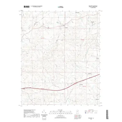
2020 Map of Fruithurst
USGS Topo · Published 2020About this map
Tallapoosa River winding through the hills of Cleburne County defines the lower half of this landscape, where small crossroads communities like Abernathy and Plainview are situated near its banks. Further north, the town of Fruithurst sits along the rail corridor, its residential grid marked by streets such as Depot St and NW Ave. This area is particularly rich in local genealogy sites, with numerous burial grounds including Fruithurst City Cem, Mount Olive Cem, and the more remote Upper Cane Creek Cem.
Find a feature on this map
32 named features on this map. Tap any name to fly to it.
Don’t see what you’re looking for? This feature index may not catch every label — zoom into the map to look around manually.
Map Details
Editions of this 2020 Fruithurst Map
This is the sole edition of this map. No revisions or reprints were ever made.
Other maps of this area

1889 · Tallapoosa
USGS Topo · 1:125,000

1892 · Tallapoosa
USGS Topo · 1:125,000

1897 · Tallapoosa
USGS Topo · 1:125,000

1900 · Anniston
USGS Topo · 1:125,000

1953 · Atlanta
USGS Topo · 1:250,000

1957 · Atlanta
USGS Topo · 1:250,000

1958 · Atlanta
USGS Topo · 1:250,000

1965 · Tallapoosa South
USGS Topo · 1:24,000

1966 · Tallapoosa North
USGS Topo · 1:24,000
1966 · Hightower
USGS Topo · 1:24,000