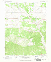
1962 Map of Fruitland
USGS Topo · Published 1970About this map
Fruitland stands as a primary point of settlement along the highway corridor in the early 1960s, a period when the landscape was defined by its transition from the high desert flats to the steep slopes of Currant Creek Mountain. A small Cem near the town center provides a point of interest for genealogists tracing early families in this part of Duchesne County. The area’s hydrology is dominated by the Currant Creek and Red Creek drainages, which carve southward toward the Strawberry River and the secluded Hayes Ponds. Outside of the main road, the terrain is marked by numerous Jeep Trails and a solitary Prospect, reflecting a landscape used for seasonal grazing, light extraction, and utility management as evidenced by the long Telephone line traversing the quadrangle. This survey illustrates the rural character of the region before more modern developments altered these backcountry routes.
Find a feature on this map
19 named features on this map. Tap any name to fly to it.
Don’t see what you’re looking for? This feature index may not catch every label — zoom into the map to look around manually.
Map Details
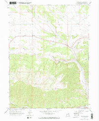
Editions of this 1962 Fruitland Map
3 editions found
Other maps of this area

1885 · Uinta
USGS Topo · 1:250,000

1954 · Salt Lake City
USGS Topo · 1:250,000

1958 · Salt Lake City
USGS Topo · 1:250,000

1960 · Salt Lake City
USGS Topo · 1:250,000

1962 · Deep Creek Canyon
USGS Topo · 1:24,000

1962 · Strawberry Pinnacles
USGS Topo · 1:24,000
1962 · Sams Canyon
USGS Topo · 1:24,000

1962 · Fruitland
USGS Topo · 1:24,000

1962 · Tabiona
USGS Topo · 1:24,000

1962 · Raspberry Knoll
USGS Topo · 1:24,000