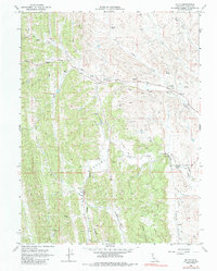
1968 Map of Fruto
USGS Topo · Published 1985About this map
The Fruto settlement in Glenn County defines this 1960s landscape, serving as a focal point for a region characterized by ranching and drainage networks. The topography is dominated by the broad Clark Valley and the smaller Squaw Flat, while a complex system of seasonal and year-round watercourses like Nye Creek, Gopher Creek, and South Fork Willow Creek crisscross the terrain. This period shows a functional working landscape where transportation is largely managed via a network of Jeep Trails and remote infrastructure, including a local Landing Strip and a Gaging Station on the creek.
Find a feature on this map
21 named features on this map. Tap any name to fly to it.
Don’t see what you’re looking for? This feature index may not catch every label — zoom into the map to look around manually.
Map Details
Editions of this 1968 Fruto Map
3 editions found
Other maps of this area

1904 · Walker Creek
USGS Topo · 1:31,680

1904 · Logan Creek
USGS Topo · 1:24,000

1917 · Kurand
USGS Topo · 1:31,680

1918 · Logan Creek
USGS Topo · 1:31,680

1919 · Fruto
USGS Topo · 1:62,500

1919 · Elk Creek
USGS Topo · 1:62,500

1943 · Lodoga
USGS Topo · 1:62,500

1944 · Fruto
USGS Topo · 1:62,500

1948 · Elk Creek
USGS Topo · 1:62,500

1951 · Stonyford
USGS Topo · 1:62,500