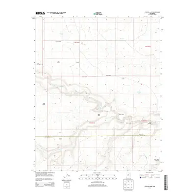
2013 Map of Frutosa Lake
USGS Topo · Published 2013About this map
The Mora River carves through the transition between high plains and canyon country in this high-desert landscape of San Miguel and Mora counties. This region is defined by its deep canyons, including Garza Canyon and Cañon Cibolo, which drain toward the river's path. Water is the primary driver of settlement here, as evidenced by the dispersed collection of family-named landmarks like Wiggins Ranch, Berlier Ranch, and Capps.
Find a feature on this map
28 named features on this map. Tap any name to fly to it.
Don’t see what you’re looking for? This feature index may not catch every label — zoom into the map to look around manually.
Map Details
Editions of this 2013 Frutosa Lake Map
This is the sole edition of this map. No revisions or reprints were ever made.
Other maps of this area

1892 · Watrous
USGS Topo · 1:125,000

1894 · Watrous
USGS Topo · 1:125,000

1954 · Santa Fe
USGS Topo · 1:250,000

1958 · Santa Fe
USGS Topo · 1:250,000

1964 · Frutosa Lake
USGS Topo · 1:24,000

1964 · Mogote Hills
USGS Topo · 1:24,000

1964 · Alamosa Creek
USGS Topo · 1:24,000

1964 · Canon Ancho
USGS Topo · 1:24,000
1966 · Cherry Valley Lake
USGS Topo · 1:24,000
1966 · Optimo
USGS Topo · 1:24,000