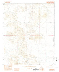
1982 Map of Fry Mountains
USGS Topo · Published 1982About this map
Fry Mountains and the surrounding desert floor dominate this early 1980s landscape in the High Desert. The topography is defined by sharp elevation shifts between the rocky slopes of Fry Mountain and the broad expanse of Johnson Valley to the east. Evidence of heavy industrial exploration is scattered throughout the terrain, particularly near the mountain's southern base where an Open Pit Mine is located. Small-scale mineral exploration is also well-documented on this sheet, with numerous prospects and isolated Mine sites marked along the ridges and washes. This transitional zone between the mountains and the valley floor at Upper highlights the rugged, utilitarian nature of the region before modern expansion. Power transmission lines cut across the northern and central sections, following the natural contours near Red Hill, marking the area's role in the regional energy infrastructure.
Find a feature on this map
10 named features on this map. Tap any name to fly to it.
Don’t see what you’re looking for? This feature index may not catch every label — zoom into the map to look around manually.
Map Details
Editions of this 1982 Fry Mountains Map
3 editions found
Other maps of this area

1901 · Southern California Sheet No. 1
USGS Topo · 1:250,000

1902 · San Gorgonio
USGS Topo · 1:125,000

1904 · Southern California Sheet No. 1
USGS Topo · 1:250,000

1947 · Lucerne Valley
USGS Topo · 1:62,500

1949 · Lucerne Valley
USGS Topo · 1:62,500

1953 · San Bernardino
USGS Topo · 1:250,000

1955 · Silver Bell Mine
USGS Topo · 1:24,000

1955 · Old Woman Springs
USGS Topo · 1:62,500

1955 · Ord Mountains
USGS Topo · 1:62,500

1955 · Rodman Mountains
USGS Topo · 1:62,500