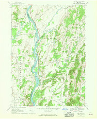
1967 Map of Ft Miller
USGS Topo · Published 1970About this map
The Hudson River serves as the central artery for this portion of eastern New York, dividing the landscape into a complex network of islands and drainage systems. This 1967 survey documents the industrial and agricultural character of the region, where the Champlain Canal runs parallel to the river's eastern bank, passing through Fort Miller and past Lock No 6. The map captures several established communities, from Northumberland and Thomson in the south to the small settlement of Durkeetown in the north.
Find a feature on this map
67 named features on this map. Tap any name to fly to it.
Don’t see what you’re looking for? This feature index may not catch every label — zoom into the map to look around manually.
Map Details
Editions of this 1967 Ft Miller Map
2 editions found
Other maps of this area

1893 · Fort Ann
USGS Topo · 1:62,500

1895 · Cambridge
USGS Topo · 1:62,500

1895 · Fort Ann
USGS Topo · 1:62,500

1895 · Glens Falls
USGS Topo · 1:62,500

1897 · Glens Falls
USGS Topo · 1:62,500

1898 · Cambridge
USGS Topo · 1:62,500

1898 · Fort Ann
USGS Topo · 1:62,500

1900 · Schuylerville
USGS Topo · 1:62,500

1901 · Fort Ann
USGS Topo · 1:62,500

1901 · Cambridge
USGS Topo · 1:62,500