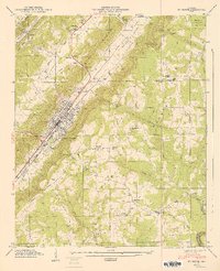
1947 Map of Ft Payne
USGS Topo · Published 1947About this map
Fort Payne sits prominently at the base of Big Valley Ridge and Lookout Mountain, where the Southern Railroad runs parallel to Big Wills Creek. This 1946 field examination captures the city as a thriving valley hub, punctuated by industrial and natural landmarks like the Airfield and Manitou Cave. The surrounding landscape is defined by its ridge-and-valley topography, with the plateau of Lookout Mountain hosting De Soto State Park and rural communities such as Pumpkin Center and Adamsburg. Genealogists will find a wealth of local landmarks including Fisher Sch, Log Cabin Chapel, and numerous family-named burial grounds like Hammack Cem and Scott Cem. The map illustrates a developed transport corridor through Wills Valley, contrasted with the winding path of the Little River along the county boundary.
Find a feature on this map
57 named features on this map. Tap any name to fly to it.
Don’t see what you’re looking for? This feature index may not catch every label — zoom into the map to look around manually.
Map Details
Editions of this 1947 Ft Payne Map
2 editions found
Other maps of this area

1886 · Stevenson
USGS Topo · 1:125,000

1892 · Stevenson
USGS Topo · 1:125,000

1893 · Fort Payne
USGS Topo · 1:125,000

1895 · Stevenson
USGS Topo · 1:125,000

1898 · Fort Payne
USGS Topo · 1:125,000

1900 · Fort Payne
USGS Topo · 1:125,000

1936 · Dugout Valley
USGS Topo · 1:24,000

1936 · Chavies
USGS Topo · 1:24,000

1936 · Sylvania
USGS Topo · 1:24,000
1936 · Little Falls
USGS Topo · 1:24,000