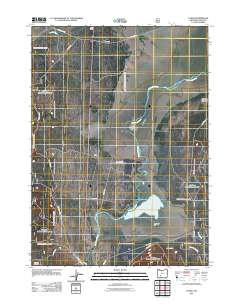
2011 Map of Fuego
USGS Topo · Published 2011About this map
The Williamson River meanders through this portion of Klamath County, defining a landscape shaped by both natural hydrology and early 20th-century ranching infrastructure. The presence of the Yamsay Land and Cattle Company Ditch reveals the region's agricultural history, where water was diverted to support livestock operations on the surrounding plains. Small settlements like Fuego and Chinchalo appear along the corridor, marking historical rail or stage stops in this high-desert environment. The terrain transitions from the open expanse of Soloman Flat to the north, where Sand Creek flows near the W Boundary Rd. A dense network of forest and service roads, including Egan Springs Rd and Kirk Rd, crisscrosses the area, reflecting the importance of land management and timber access in the eastern Cascades during this era.
Find a feature on this map
22 named features on this map. Tap any name to fly to it.
Don’t see what you’re looking for? This feature index may not catch every label — zoom into the map to look around manually.
Map Details
Editions of this 2011 Fuego Map
This is the sole edition of this map. No revisions or reprints were ever made.
Other maps of this area

1889 · Klamath
USGS Topo · 1:250,000

1894 · Klamath
USGS Topo · 1:250,000

1955 · Klamath Falls
USGS Topo · 1:250,000

1956 · Calimus Butte
USGS Topo · 1:62,500

1957 · Chiloquin
USGS Topo · 1:62,500

1957 · Klamath Marsh
USGS Topo · 1:62,500

1957 · Lenz
USGS Topo · 1:62,500

1958 · Klamath Falls
USGS Topo · 1:250,000

1980 · Williamson River
USGS Topo · 1:100,000
1985 · Pothole Butte
USGS Topo · 1:24,000