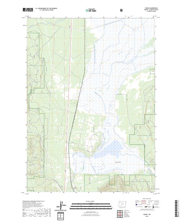
2024 Map of Fuego
USGS Topo · Published 2024About this map
The Williamson River meanders through a landscape defined by conservation and complex water management in this high-desert region. Broad wetland areas are preserved within the Klamath Marsh National Wildlife Refuge and the surrounding Winema National Forest, where the hydrology is shaped by early irrigation infrastructure. A network of man-made waterways, including the Yamsay Land and Cattle Company Ditch, Hobbs Ditch, and Gerwick Ditch, illustrates the historic efforts to divert water for ranching and agriculture across the Soloman Flat. The small settlement of Kirk remains a central point of interest for researchers tracing the development of Klamath County, situated near the intersection of several forest roads like Fuego Rd and Kirk Rd. Other seasonal watercourses such as Sand Creek and Hog Creek feed into this unique riparian environment.
Find a feature on this map
20 named features on this map. Tap any name to fly to it.
Don’t see what you’re looking for? This feature index may not catch every label — zoom into the map to look around manually.
Map Details
Editions of this 2024 Fuego Map
This is the sole edition of this map. No revisions or reprints were ever made.
Other maps of this area

1889 · Klamath
USGS Topo · 1:250,000

1894 · Klamath
USGS Topo · 1:250,000

1955 · Klamath Falls
USGS Topo · 1:250,000

1956 · Calimus Butte
USGS Topo · 1:62,500

1957 · Chiloquin
USGS Topo · 1:62,500

1957 · Klamath Marsh
USGS Topo · 1:62,500

1957 · Lenz
USGS Topo · 1:62,500

1958 · Klamath Falls
USGS Topo · 1:250,000

1980 · Williamson River
USGS Topo · 1:100,000
1985 · Pothole Butte
USGS Topo · 1:24,000