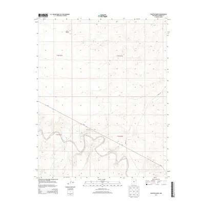
2013 Map of Fuentes Ranch
USGS Topo · Published 2013About this map
The high plains of Harding County define this landscape, where the isolated Fuentes Ranch and the nearby Cluck settlement represent the sparse human footprint in this part of northeastern New Mexico. Located along the winding route of NM-39, these locations are tied to the ranching heritage of the region, which relies on vital water infrastructure like the South Honeycutt Windmill found in the northern sections. The map reveals a transition from flat tablelands to more complex, incised drainage patterns in the southern half, where Rosebud Rd intersects the local road network. This survey preserves the exact placement of these rural homesteads and transport corridors before further modern changes to the high desert ranching economy.
Find a feature on this map
9 named features on this map. Tap any name to fly to it.
Don’t see what you’re looking for? This feature index may not catch every label — zoom into the map to look around manually.
Map Details
Editions of this 2013 Fuentes Ranch Map
This is the sole edition of this map. No revisions or reprints were ever made.
Other maps of this area

1930 · Tucumcari
USGS Topo · 1:125,000

1954 · Tucumcari
USGS Topo · 1:250,000

1958 · Tucumcari
USGS Topo · 1:250,000

1962 · Logan
USGS Topo · 1:62,500

1966 · Mc Carty Ranch
USGS Topo · 1:24,000

1966 · Mc Cloy Ranch
USGS Topo · 1:24,000

1968 · Hampton Ranch
USGS Topo · 1:24,000

1968 · Montesito Creek
USGS Topo · 1:24,000

1969 · Gallegos
USGS Topo · 1:24,000

1969 · Gallegos NE
USGS Topo · 1:24,000