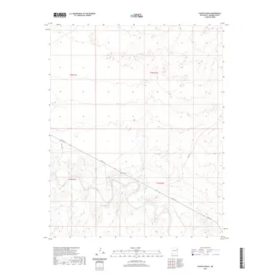
2020 Map of Fuentes Ranch
USGS Topo · Published 2020About this map
Fuentes Ranch serves as the central landmark of this Harding County landscape, positioned near the intersection of several local routes. The terrain is characterized by the winding path of a canyon system that cuts through the High Plains, illustrating the topographical challenges faced by ranching operations in this part of northeastern New Mexico. Transportation in the area relies on a network of unpaved tracks, including Ute Camp Rd and Rosebud Rd, which follow the natural contours of the land. The presence of Co Rd N-3-5 provides the primary corridor through the quadrangle, linking the isolated ranching outposts to the wider region during the early 21st century.
Find a feature on this map
8 named features on this map. Tap any name to fly to it.
Don’t see what you’re looking for? This feature index may not catch every label — zoom into the map to look around manually.
Map Details
Editions of this 2020 Fuentes Ranch Map
This is the sole edition of this map. No revisions or reprints were ever made.
Other maps of this area

1930 · Tucumcari
USGS Topo · 1:125,000

1954 · Tucumcari
USGS Topo · 1:250,000

1958 · Tucumcari
USGS Topo · 1:250,000

1962 · Logan
USGS Topo · 1:62,500

1966 · Mc Carty Ranch
USGS Topo · 1:24,000

1966 · Mc Cloy Ranch
USGS Topo · 1:24,000

1968 · Hampton Ranch
USGS Topo · 1:24,000

1968 · Montesito Creek
USGS Topo · 1:24,000

1969 · Gallegos
USGS Topo · 1:24,000

1969 · Gallegos NE
USGS Topo · 1:24,000