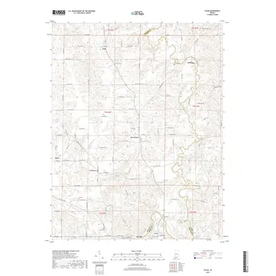
2019 Map of Fulda
USGS Topo · Published 2019About this map
The Anderson River and its Middle Fork carve a winding course through this section of the Indiana countryside along the border of Spencer and Perry counties. The settlement of Fulda sits in the north, while the riverside town of Troy anchors the southern edge near the river's bend. This 2019 survey documents a landscape defined by small rural communities and family legacies, evidenced by numerous burial grounds such as Butler Cem, Huffman Cem, and Avery Cem. Further inland, the map identifies small clusters like New Boston, Evanston, and Schley. The presence of Grame Airport in the northeast corner and a dense network of county roads, including N Huffman Mill Rd and Aetna Rd, illustrates the modern connectivity of these long-established agrarian townships and river-adjacent villages.
Find a feature on this map
89 named features on this map. Tap any name to fly to it.
Don’t see what you’re looking for? This feature index may not catch every label — zoom into the map to look around manually.
Map Details
Editions of this 2019 Fulda Map
This is the sole edition of this map. No revisions or reprints were ever made.
Other maps of this area

1900 · St Meinrad
USGS Topo · 1:62,500

1903 · St. Meinrad
USGS Topo · 1:62,500

1903 · Tell City
USGS Topo · 1:62,500

1934 · Cannelton
USGS Topo · 1:62,500

1949 · Cannelton
USGS Topo · 1:24,000

1953 · Cannelton
USGS Topo · 1:24,000

1953 · Lewisport
USGS Topo · 1:24,000

1953 · Tell City
USGS Topo · 1:24,000

1954 · Evansville
USGS Topo · 1:250,000

1956 · Vincennes
USGS Topo · 1:250,000