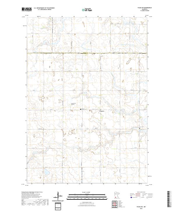
2022 Map of Fulda SW
USGS Topo · Published 2022About this map
The Coteau des Prairies plateau defines this agricultural landscape in Southwest Minnesota, where the drainage patterns are marked by a sophisticated network of man-made waterways. Systems such as County Ditch Number Eighty, Judicial Ditch Number Twenty, and Judicial Ditch Number Twelve illustrate the extensive late-19th and early-20th-century efforts to reclaim wetland for farming. This 2022 survey captures the modern rural layout where the small settlement of Pfingsten sits near the American Lutheran Cem, serving as a local anchor for the surrounding farmsteads.
Find a feature on this map
38 named features on this map. Tap any name to fly to it.
Don’t see what you’re looking for? This feature index may not catch every label — zoom into the map to look around manually.
Map Details
Editions of this 2022 Fulda SW Map
This is the sole edition of this map. No revisions or reprints were ever made.
Other maps of this area

1954 · Fairmont
USGS Topo · 1:250,000

1958 · Fairmont
USGS Topo · 1:250,000

1960 · Reading
USGS Topo · 1:24,000

1960 · Worthington North
USGS Topo · 1:24,000

1967 · Slayton
USGS Topo · 1:24,000

1967 · Wilmont
USGS Topo · 1:24,000

1967 · Adrian NE
USGS Topo · 1:24,000

1970 · Fulda
USGS Topo · 1:24,000
1970 · Fulda SW
USGS Topo · 1:24,000
1970 · Lime Creek
USGS Topo · 1:24,000