1962 Map of Fulford
USGS Topo · Published 1987About this map
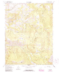
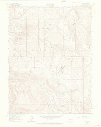
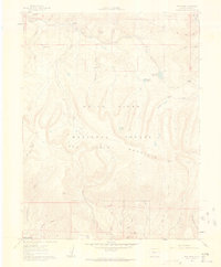
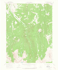
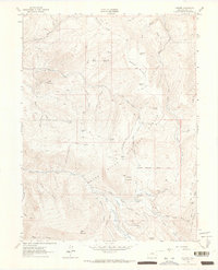
Fulford sits at the heart of this high-elevation terrain, a settlement surrounded by the mining history and rugged hydrology of the White River National Forest. Evidence of the area's mineral prospects appears at the Lady Belle Mine and Polar Star Mine, while the agricultural and utility history of the landscape is marked by the Bemis Ditch following the contours of Salt Creek. The map shows a transition from the lower gulches to the high peaks of Adam Mountain and Porphyry Mountain, punctuated by open spaces like Metheny Park and Yeoman Park.
Find a feature on this map
51 named features on this map. Tap any name to fly to it.
Don’t see what you’re looking for? This feature index may not catch every label — zoom into the map to look around manually.
Map Details
Editions of this 1962 Fulford Map
4 editions found

Other maps of this area

1909 · Mount Jackson
USGS Topo · 1:125,000

1911 · Mount Jackson
USGS Topo · 1:125,000

1957 · Leadville
USGS Topo · 1:250,000

1959 · Leadville
USGS Topo · 1:250,000

1960 · Leadville
USGS Topo · 1:250,000
1961 · Red Creek
USGS Topo · 1:24,000

1962 · Leadville
USGS Topo · 1:250,000
1962 · Grouse Mountain
USGS Topo · 1:24,000
1962 · Fulford
USGS Topo · 1:24,000
1962 · Wolcott
USGS Topo · 1:24,000