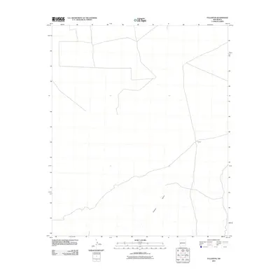
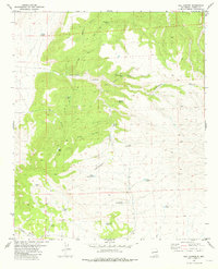
2010 Map of Fullerton
USGS Topo · Published 2010About this map
Fullerton sits in a high-desert landscape of southwestern New Mexico, as documented in this 2010 U. S. Geological Survey topographic study. The area is defined by the sharp transition between the broad, level plateau and the deeply carved drainage of Fullerton Canyon to the south. This remote ranching country in Catron County shows a sparse network of local roads and unimproved trails that follow the natural contours of the land, illustrating the persistent isolation and expansive land use typical of the region. The map provides a clear look at the few structures and physical landmarks that define this pocket of the American Southwest during the early 21st century.
Find a feature on this map
2 named features on this map. Tap any name to fly to it.
Don’t see what you’re looking for? This feature index may not catch every label — zoom into the map to look around manually.
Map Details
Editions of this 2010 Fullerton Map
This is the sole edition of this map. No revisions or reprints were ever made.
Other maps of this area

1918 · Pelona
USGS Topo · 1:125,000

1954 · Clifton
USGS Topo · 1:250,000

1957 · Clifton
USGS Topo · 1:250,000

1958 · Clifton
USGS Topo · 1:250,000

1962 · Clifton
USGS Topo · 1:250,000

1981 · Fullerton
USGS Topo · 1:24,000
1981 · Bell Peak
USGS Topo · 1:24,000
1981 · Pelona Mountain
USGS Topo · 1:24,000
1981 · Horse Mountain West
USGS Topo · 1:24,000
1981 · Rail Canyon
USGS Topo · 1:24,000