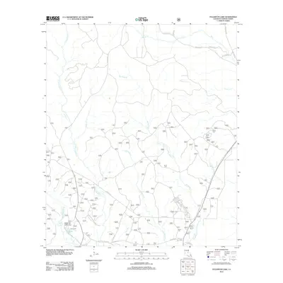
2012 Map of Fullerton Lake
USGS Topo · Published 2012About this map
Fullerton Mill stands as a central point of interest in this Vernon Parish landscape, where the legacy of the regional timber and milling industry is still etched into the terrain. The area is defined by a dense network of watercourses, including the serpentine paths of Big Brushy Creek and Little Brushy Creek, which converge and wind through the southern sections. This 2012 record captures the transition of the former mill site into a recreational landscape, anchored by Fullerton Lake and the Fullerton Lake Campground and Picnic Area. For those tracing local families, the map preserves the locations of Smith Cem and Semon Cem, both situated along the rural corridors of Lookout Road and Boundary Road. The map's layout illustrates how early industrial hubs evolved into modern conservation and managed forest lands, connected by a web of parish and forestry service roads.
Find a feature on this map
28 named features on this map. Tap any name to fly to it.
Don’t see what you’re looking for? This feature index may not catch every label — zoom into the map to look around manually.
Map Details
Editions of this 2012 Fullerton Lake Map
This is the sole edition of this map. No revisions or reprints were ever made.
Other maps of this area

1941 · Slagle
USGS Topo · 1:62,500

1943 · Leander
USGS Topo · 1:62,500

1944 · Slagle
USGS Topo · 1:62,500

1947 · Steep Gully
USGS Topo · 1:31,680

1947 · Sugrue
USGS Topo · 1:31,680

1947 · Pitkin
USGS Topo · 1:31,680
1951 · Pitkin
USGS Topo · 1:24,000

1951 · Steep Gully
USGS Topo · 1:24,000

1952 · Lake Charles
USGS Topo · 1:250,000

1953 · Alexandria
USGS Topo · 1:250,000