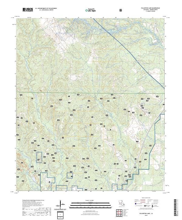
2024 Map of Fullerton Lake
USGS Topo · Published 2024About this map
Kisatchie National Forest dominates this section of Vernon Parish, where the land is defined by a dense network of watercourses including the West Fork Sixmile Creek and East Fork Sixmile Creek. The geography reveals a mix of protected federal lands and the northern reaches of Fort Polk, interspersed with local landmarks that speak to the area's social history. For genealogists, the map identifies small burial sites like Smith Cem and Semon Cem, often the only remaining markers of early rural communities. The landscape is navigated by a system of forestry and parish roads such as Lookout Rd and Parish Rd 58, alongside recreational paths like the Whiskey Chitto Trl and Fullerton Lake Trl. The presence of Fullerton Lake at the southern edge suggests a focal point for local industry or recreation within the timber-rich piney woods of central Louisiana.
Find a feature on this map
34 named features on this map. Tap any name to fly to it.
Don’t see what you’re looking for? This feature index may not catch every label — zoom into the map to look around manually.
Map Details
Editions of this 2024 Fullerton Lake Map
This is the sole edition of this map. No revisions or reprints were ever made.
Other maps of this area

1941 · Slagle
USGS Topo · 1:62,500

1943 · Leander
USGS Topo · 1:62,500

1944 · Slagle
USGS Topo · 1:62,500

1947 · Steep Gully
USGS Topo · 1:31,680

1947 · Sugrue
USGS Topo · 1:31,680

1947 · Pitkin
USGS Topo · 1:31,680
1951 · Pitkin
USGS Topo · 1:24,000

1951 · Steep Gully
USGS Topo · 1:24,000

1952 · Lake Charles
USGS Topo · 1:250,000

1953 · Alexandria
USGS Topo · 1:250,000