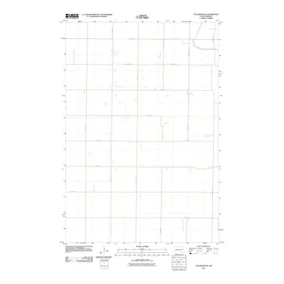
2011 Map of Fullerton NE
USGS Topo · Published 2011About this map
The James River meanders through the northeast corner of this landscape, defining the topography of an otherwise strictly gridded rural expanse. Established section lines and agricultural boundaries govern the territory, manifested in a meticulous network of gravel and local roads such as 81st St Se and 100th Ave Se. This 2011 survey by the U.S. Geological Survey shows a prairie environment shaped by the Public Land Survey System, where the arterial County Road A serves as a primary transit corridor. Small wetlands and intermittent depressions are scattered throughout the sections, particularly along the drainage patterns near the river, illustrating the prairie pothole character of this part of Dickey County.
Find a feature on this map
16 named features on this map. Tap any name to fly to it.
Don’t see what you’re looking for? This feature index may not catch every label — zoom into the map to look around manually.
Map Details
Editions of this 2011 Fullerton NE Map
This is the sole edition of this map. No revisions or reprints were ever made.
Other maps of this area

1894 · La Moure
USGS Topo · 1:62,500

1894 · Fullerton
USGS Topo · 1:62,500

1894 · Oakes
USGS Topo · 1:62,500

1895 · Lamoure
USGS Topo · 1:125,000

1918 · La Moure
USGS Topo · 1:125,000

1952 · Glover
USGS Topo · 1:24,000

1952 · Independence
USGS Topo · 1:24,000

1953 · Jamestown
USGS Topo · 1:250,000

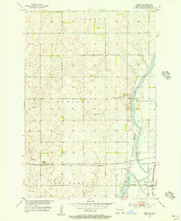
1955 · Fullerton NE
USGS Topo · 1:24,000
1955 · Guelph
USGS Topo · 1:24,000
Featured Places
- Clement Township, ND
- Yorktown Township, ND
- Wright Township, ND
- James River Valley Township, ND
- Dickey County, ND