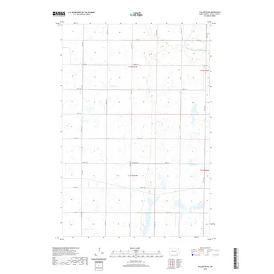
2020 Map of Fullerton NE
USGS Topo · Published 2020About this map
James River meanders through the northeastern corner of this Dickey County landscape, carving a distinct valley into the prairie terrain. The region is defined by a rigorous grid of section lines and gravel roads such as Baldwin Rd and Horseshoe Dr, reflecting the enduring structure of the Public Land Survey System. Wetland pockets and small prairie potholes are scattered across the townships, illustrating the glacial legacy of the northern plains. While the map is dominated by open agricultural land, the inclusion of routes like Co 3 and Co Rd A indicates the primary corridors connecting the rural homesteads of Clement Township. This 2020 survey documents the modern drainage patterns and road networks that have supported North Dakota's farming economy for generations.
Find a feature on this map
23 named features on this map. Tap any name to fly to it.
Don’t see what you’re looking for? This feature index may not catch every label — zoom into the map to look around manually.
Map Details
Editions of this 2020 Fullerton NE Map
This is the sole edition of this map. No revisions or reprints were ever made.
Other maps of this area

1894 · La Moure
USGS Topo · 1:62,500

1894 · Fullerton
USGS Topo · 1:62,500

1894 · Oakes
USGS Topo · 1:62,500

1895 · Lamoure
USGS Topo · 1:125,000

1918 · La Moure
USGS Topo · 1:125,000

1952 · Glover
USGS Topo · 1:24,000

1952 · Independence
USGS Topo · 1:24,000

1953 · Jamestown
USGS Topo · 1:250,000

1955 · Fullerton NE
USGS Topo · 1:24,000
1955 · Guelph
USGS Topo · 1:24,000
Featured Places
- Clement Township, ND
- Yorktown Township, ND
- Wright Township, ND
- James River Valley Township, ND
- Dickey County, ND