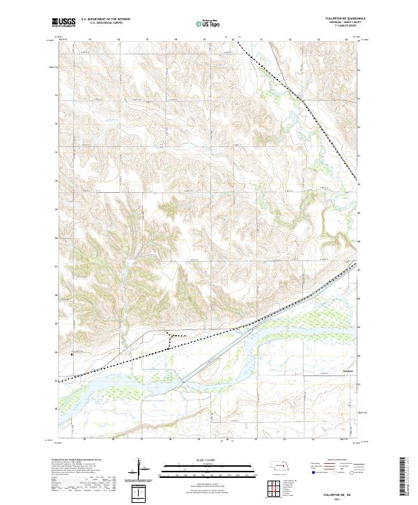
2021 Map of Fullerton NE
USGS Topo · Published 2021About this map
The Loup River dominates the southern reaches of this landscape, its wide channel accompanied by the parallel course of the Loup River Canal. This water-rich region is further defined by several tributaries, including Skeedee Cr, Council Cr, and Beaver Creek, which drain the undulating terrain of Nance County. The small settlement of Krakow sits at a rural crossroads in the southeast, serving as a localized point of interest for researchers of Nebraska's agricultural history. Near the western edge, Sunnyside Cem provides a specific point for genealogical mapping. The grid of section lines and local roads like N Husk Rd and N Impala Ln organizes the countryside, reflecting the systematic land division that characterizes this part of the Great Plains.
Find a feature on this map
26 named features on this map. Tap any name to fly to it.
Don’t see what you’re looking for? This feature index may not catch every label — zoom into the map to look around manually.
Map Details
Editions of this 2021 Fullerton NE Map
This is the sole edition of this map. No revisions or reprints were ever made.
Other maps of this area

1896 · Stromsburg
USGS Topo · 1:125,000

1955 · Fremont
USGS Topo · 1:250,000

1957 · Fremont
USGS Topo · 1:250,000

1958 · Fremont
USGS Topo · 1:250,000

1958 · Genoa
USGS Topo · 1:24,000
1958 · Merchiston
USGS Topo · 1:24,000

1958 · Fullerton
USGS Topo · 1:24,000

1958 · Fullerton NE
USGS Topo · 1:24,000

1958 · Silver Creek
USGS Topo · 1:24,000

1958 · Havens
USGS Topo · 1:24,000