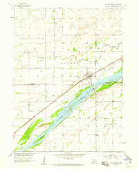
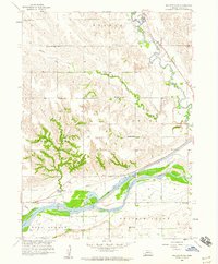
1958 Map of Silver Creek
USGS Topo · Published 1959About this map
The village of Silver Creek serves as a hub for this agricultural landscape, situated where the Union Pacific railroad parallels the broad, braided course of the Platte River. This 1950s survey captures the region during the development of the Missouri River Basin, illustrating a network of rural school districts and religious sites that defined Nebraska's eastern plains. The terrain is dominated by the wide Platte Valley, where the river splits into multiple streams including the South Channel.
Find a feature on this map
16 named features on this map. Tap any name to fly to it.
Don’t see what you’re looking for? This feature index may not catch every label — zoom into the map to look around manually.
Map Details
Editions of this 1958 Silver Creek Map
This is the sole edition of this map. No revisions or reprints were ever made.
Other maps of this area

1896 · Stromsburg
USGS Topo · 1:125,000

1955 · Fremont
USGS Topo · 1:250,000

1957 · Fremont
USGS Topo · 1:250,000

1958 · Fremont
USGS Topo · 1:250,000
1958 · Genoa
USGS Topo · 1:24,000
1958 · Monroe
USGS Topo · 1:24,000
1958 · Silver Creek SE
USGS Topo · 1:24,000
1958 · Fullerton NE
USGS Topo · 1:24,000
1958 · Havens
USGS Topo · 1:24,000
1962 · Swedehome
USGS Topo · 1:24,000