
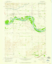
1958 Map of Monroe
USGS Topo · Published 1959About this map
The village of Monroe and the settlement of Oconee define this mid-century landscape along the braided channels of the Loup River. This survey, conducted as part of the Department of the Interior program for the development of the Missouri River Basin, highlights the intricate water management system of the era, including the Loup River Canal, a prominent Levee, and an associated powerplant. The Union Pacific tracks parallel the waterway, providing the vital rail link that shaped the growth of these Platte County communities.
Find a feature on this map
22 named features on this map. Tap any name to fly to it.
Don’t see what you’re looking for? This feature index may not catch every label — zoom into the map to look around manually.
Map Details
Editions of this 1958 Monroe Map
2 editions found
Other maps of this area

1896 · Stromsburg
USGS Topo · 1:125,000

1899 · David City
USGS Topo · 1:125,000

1955 · Fremont
USGS Topo · 1:250,000

1957 · Fremont
USGS Topo · 1:250,000

1958 · Fremont
USGS Topo · 1:250,000

1958 · Genoa
USGS Topo · 1:24,000

1958 · Duncan
USGS Topo · 1:24,000

1958 · Columbus SW
USGS Topo · 1:24,000

1958 · Silver Creek SE
USGS Topo · 1:24,000

1958 · Silver Creek
USGS Topo · 1:24,000