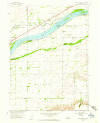
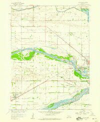
1958 Map of Silver Creek SE
USGS Topo · Published 1959About this map
Platte River braided channels dominate this late 1950s landscape, illustrating the complex river system before modern hydrological changes altered the Nebraska plains. The map details the intersection of Merrick, Platte, and Polk counties, where agricultural life is anchored by a network of rural schoolhouses and churches. The Union Pacific railroad runs parallel to the river, serving the settlement at Gardiner.
Find a feature on this map
20 named features on this map. Tap any name to fly to it.
Don’t see what you’re looking for? This feature index may not catch every label — zoom into the map to look around manually.
Map Details
Editions of this 1958 Silver Creek SE Map
This is the sole edition of this map. No revisions or reprints were ever made.
Other maps of this area

1896 · Stromsburg
USGS Topo · 1:125,000
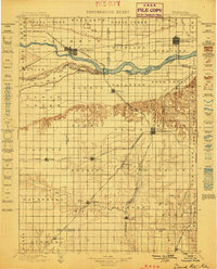
1899 · David City
USGS Topo · 1:125,000

1955 · Fremont
USGS Topo · 1:250,000

1957 · Fremont
USGS Topo · 1:250,000

1958 · Fremont
USGS Topo · 1:250,000
1958 · Genoa
USGS Topo · 1:24,000
1958 · Monroe
USGS Topo · 1:24,000
1958 · Duncan
USGS Topo · 1:24,000
1958 · Columbus SW
USGS Topo · 1:24,000
1958 · Silver Creek
USGS Topo · 1:24,000