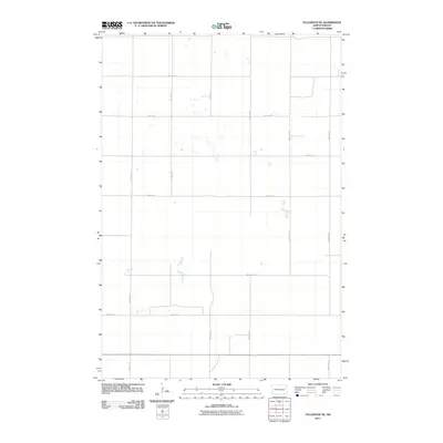
2011 Map of Fullerton SE
USGS Topo · Published 2011About this map
Agricultural plots and prairie wetlands define the landscape of Clement Township in the early twenty-first century. This survey reflects the strictly organized Section Line road system characteristic of the Great Plains, where routes like 98th Ave SE and 100th Ave SE form a precise grid across the North Dakota terrain. The map captures the subtle hydrography of the region, featuring numerous small, unnamed prairie potholes and seasonal water bodies that dot the land between 95th St SE and 90th St SE. While formal settlements are absent from this specific quadrangle, the network of rural roads such as 102nd Ave SE and 93rd St SE provides a clear view of the land division and access points used by local farming operations during this era.
Find a feature on this map
12 named features on this map. Tap any name to fly to it.
Don’t see what you’re looking for? This feature index may not catch every label — zoom into the map to look around manually.
Map Details
Editions of this 2011 Fullerton SE Map
This is the sole edition of this map. No revisions or reprints were ever made.
Other maps of this area

1894 · Hecla
USGS Topo · 1:62,500

1894 · Savo
USGS Topo · 1:62,500

1894 · Fullerton
USGS Topo · 1:62,500

1894 · Oakes
USGS Topo · 1:62,500

1895 · Lamoure
USGS Topo · 1:125,000

1896 · Columbia
USGS Topo · 1:125,000

1918 · La Moure
USGS Topo · 1:125,000

1952 · Glover
USGS Topo · 1:24,000

1953 · Jamestown
USGS Topo · 1:250,000

1954 · Aberdeen
USGS Topo · 1:250,000