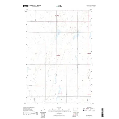
2020 Map of Fullerton SE
USGS Topo · Published 2020About this map
Dickey County's prairie landscape is defined by the rigid grid of the Public Land Survey System, which organized the territory into townships like t130n r61w and t131n r61w. This layout, clearly visible through the network of section lines and range markers, reflects the systematic agricultural development of the North Dakota plains. The terrain is marked by numerous small depressions and wetlands typical of the region's glacial history, intersected by a network of rural routes such as 90th St SE and Co Rd 10. While the area is largely devoid of concentrated settlements, the precise mapping of local roads like 97th St SE and 101st Ave SE provides an essential framework for genealogists and local historians tracing land ownership and family farmsteads in the rural townships south of Fullerton.
Find a feature on this map
21 named features on this map. Tap any name to fly to it.
Don’t see what you’re looking for? This feature index may not catch every label — zoom into the map to look around manually.
Map Details
Editions of this 2020 Fullerton SE Map
This is the sole edition of this map. No revisions or reprints were ever made.
Other maps of this area

1894 · Hecla
USGS Topo · 1:62,500

1894 · Savo
USGS Topo · 1:62,500

1894 · Fullerton
USGS Topo · 1:62,500

1894 · Oakes
USGS Topo · 1:62,500

1895 · Lamoure
USGS Topo · 1:125,000

1896 · Columbia
USGS Topo · 1:125,000

1918 · La Moure
USGS Topo · 1:125,000

1952 · Glover
USGS Topo · 1:24,000

1953 · Jamestown
USGS Topo · 1:250,000

1954 · Aberdeen
USGS Topo · 1:250,000