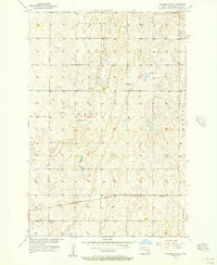
1955 Map of Fullerton SE
USGS Topo · Published 1956About this map
Port Emma and the surrounding townships in Dickey County define this 1950s agrarian landscape, where the Great Northern Railroad cuts through the southeastern plains. The map illustrates a strictly organized rural society established during the mid-century, evidenced by the regular spacing of one-room schoolhouses like School No 1, School No 2, and School No 4 serving the scattered farmsteads.
Find a feature on this map
11 named features on this map. Tap any name to fly to it.
Don’t see what you’re looking for? This feature index may not catch every label — zoom into the map to look around manually.
Map Details
Editions of this 1955 Fullerton SE Map
This is the sole edition of this map. No revisions or reprints were ever made.
Other maps of this area

1894 · Hecla
USGS Topo · 1:62,500

1894 · Savo
USGS Topo · 1:62,500

1894 · Fullerton
USGS Topo · 1:62,500

1894 · Oakes
USGS Topo · 1:62,500

1895 · Lamoure
USGS Topo · 1:125,000

1896 · Columbia
USGS Topo · 1:125,000

1918 · La Moure
USGS Topo · 1:125,000

1952 · Glover
USGS Topo · 1:24,000

1953 · Jamestown
USGS Topo · 1:250,000

1954 · Aberdeen
USGS Topo · 1:250,000