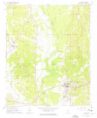
1965 Map of Fulton
USGS Topo · Published 1976About this map
The Tombigbee River snakes through the heart of Itawamba County in this mid-1960s survey, defining a landscape of wetlands and winding tributaries like Twentymile Creek and Mantachie Creek. The town of Fulton serves as the primary hub, situated near the river and the Mississippian railroad line. Evidence of much earlier habitation is preserved at the Indian Mound located south of Queen Lake, providing a distinct archaeological layer to the region's history.
Find a feature on this map
33 named features on this map. Tap any name to fly to it.
Don’t see what you’re looking for? This feature index may not catch every label — zoom into the map to look around manually.
Map Details
Editions of this 1965 Fulton Map
3 editions found
Other maps of this area

1921 · Tupelo
USGS Topo · 1:48,000

1923 · Tupelo
USGS Topo · 1:62,500

1956 · Tupelo
USGS Topo · 1:250,000

1958 · Tupelo
USGS Topo · 1:250,000

1965 · Mooreville
USGS Topo · 1:24,000

1965 · Fulton SE
USGS Topo · 1:24,000

1965 · Fulton
USGS Topo · 1:24,000
1965 · Fulton NE
USGS Topo · 1:24,000

1965 · Kirkville
USGS Topo · 1:24,000

1966 · Beans Ferry
USGS Topo · 1:24,000