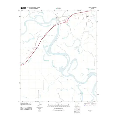
2011 Map of Fulton
USGS Topo · Published 2011About this map
The Red River meanders heavily through this portion of Hempstead County, creating a landscape defined by oxbow lakes and complex bayous. Near the northern bend of the river sits Fulton, a settlement situated at a historic river crossing point. The presence of Old Allens Ferry and the Fulton Cemetery point to the long-standing importance of this location for local transit and community life. The river’s shifting course is evident in the numerous water bodies that now sit isolated from the main channel, including Adams Cut-off Lake, Kuykendall Lake, and First Old River Lake.
Find a feature on this map
43 named features on this map. Tap any name to fly to it.
Don’t see what you’re looking for? This feature index may not catch every label — zoom into the map to look around manually.
Map Details
Editions of this 2011 Fulton Map
This is the sole edition of this map. No revisions or reprints were ever made.
Other maps of this area

1950 · Red Bluff
USGS Topo · 1:24,000

1951 · Red Bluff
USGS Topo · 1:24,000

1951 · Homan
USGS Topo · 1:24,000

1951 · Fulton
USGS Topo · 1:24,000

1951 · Sheppard
USGS Topo · 1:24,000

1951 · Spring Hill
USGS Topo · 1:24,000

1951 · Mc Nab
USGS Topo · 1:24,000

1952 · Mandeville
USGS Topo · 1:24,000

1952 · Fouke NE
USGS Topo · 1:24,000

1952 · Boyd Hill
USGS Topo · 1:24,000