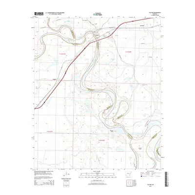
2014 Map of Fulton
USGS Topo · Published 2014About this map
Fulton stands at a significant river bend where the Little River joins the Red River, a location historically defined by its strategic position at the intersection of water and land travel. The complex hydrology of the river bottomlands is evident in the numerous oxbows and backwaters such as Old River Lake, Scott Lake, and First Old River Lake, which trace the shifting path of the river over decades. Beyond the river banks, the landscape includes small settlements like Sprudel and Clipper, alongside local burial sites including Fulton Cem and Red Hill Cem. The terrain is marked by significant natural features like Buzzard Bluff and Summers Island, while the flow of Bois d'Arc Bayou and Finn Bayou further defines the low-lying drainage patterns of Hempstead and Miller counties.
Find a feature on this map
38 named features on this map. Tap any name to fly to it.
Don’t see what you’re looking for? This feature index may not catch every label — zoom into the map to look around manually.
Map Details
Editions of this 2014 Fulton Map
This is the sole edition of this map. No revisions or reprints were ever made.
Other maps of this area

1950 · Red Bluff
USGS Topo · 1:24,000

1951 · Red Bluff
USGS Topo · 1:24,000

1951 · Homan
USGS Topo · 1:24,000

1951 · Fulton
USGS Topo · 1:24,000

1951 · Sheppard
USGS Topo · 1:24,000

1951 · Spring Hill
USGS Topo · 1:24,000

1951 · Mc Nab
USGS Topo · 1:24,000

1952 · Mandeville
USGS Topo · 1:24,000

1952 · Fouke NE
USGS Topo · 1:24,000

1952 · Boyd Hill
USGS Topo · 1:24,000