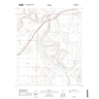
2020 Map of Fulton
USGS Topo · Published 2020About this map
The Red River carves a dramatic, winding path through the southwest Arkansas landscape, forming a complex boundary between Miller and Hempstead counties. At the heart of this oxbow-rich river valley sits Fulton, a historic river town positioned where the main channel begins a deep southward loop. The surrounding bottomlands are defined by former river channels and cutoff meanders, now preserved as Old River Lake, Mud Lake, and Bluff Lake.
Find a feature on this map
52 named features on this map. Tap any name to fly to it.
Don’t see what you’re looking for? This feature index may not catch every label — zoom into the map to look around manually.
Map Details
Editions of this 2020 Fulton Map
This is the sole edition of this map. No revisions or reprints were ever made.
Other maps of this area

1950 · Red Bluff
USGS Topo · 1:24,000

1951 · Red Bluff
USGS Topo · 1:24,000

1951 · Homan
USGS Topo · 1:24,000

1951 · Fulton
USGS Topo · 1:24,000

1951 · Sheppard
USGS Topo · 1:24,000

1951 · Spring Hill
USGS Topo · 1:24,000

1951 · Mc Nab
USGS Topo · 1:24,000

1952 · Mandeville
USGS Topo · 1:24,000

1952 · Fouke NE
USGS Topo · 1:24,000

1952 · Boyd Hill
USGS Topo · 1:24,000