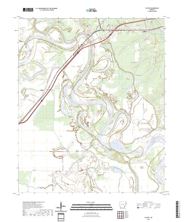
2024 Map of Fulton
USGS Topo · Published 2024About this map
Fulton occupies a strategic bend in the Red River where the Little River joins the flow, marking a landscape defined by shifting oxbows and river bottomlands. The intricate hydrology of this region is evident in the numerous water bodies that mirror the river's path, including Old River Lake, Mud Lake, and Bluff Lake. These features reflect a dynamic fluvial history where the main channel has carved and abandoned paths over generations.
Find a feature on this map
53 named features on this map. Tap any name to fly to it.
Don’t see what you’re looking for? This feature index may not catch every label — zoom into the map to look around manually.
Map Details
Editions of this 2024 Fulton Map
This is the sole edition of this map. No revisions or reprints were ever made.
Other maps of this area

1950 · Red Bluff
USGS Topo · 1:24,000

1951 · Red Bluff
USGS Topo · 1:24,000

1951 · Homan
USGS Topo · 1:24,000

1951 · Fulton
USGS Topo · 1:24,000

1951 · Sheppard
USGS Topo · 1:24,000

1951 · Spring Hill
USGS Topo · 1:24,000

1951 · Mc Nab
USGS Topo · 1:24,000

1952 · Mandeville
USGS Topo · 1:24,000

1952 · Fouke NE
USGS Topo · 1:24,000

1952 · Boyd Hill
USGS Topo · 1:24,000