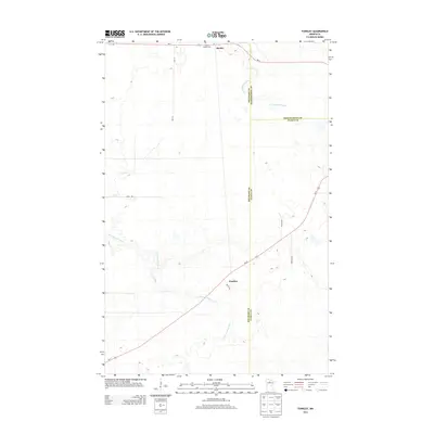
2013 Map of Funkley
USGS Topo · Published 2013About this map
Funkley and Shooks anchor this northern Minnesota landscape at the meeting point of three counties. This survey captures a rural territory where the N Cormorant River and S Cormorant River wind through low-lying terrain, defining the local hydrology alongside smaller tributaries like Perry Cr and Fish Cr. The map reveals a precise boundary intersection where Beltrami, Koochiching, and Itasca counties converge, a detail of particular interest for researchers of jurisdictional history and property records.
Find a feature on this map
17 named features on this map. Tap any name to fly to it.
Don’t see what you’re looking for? This feature index may not catch every label — zoom into the map to look around manually.
Map Details
Editions of this 2013 Funkley Map
This is the sole edition of this map. No revisions or reprints were ever made.
Other maps of this area

1919 · Rosy
USGS Topo · 1:62,500

1919 · Quiring
USGS Topo · 1:62,500

1919 · Bridgie
USGS Topo · 1:62,500

1924 · Bridgie
USGS Topo · 1:62,500

1954 · Bemidji
USGS Topo · 1:250,000

1957 · Bemidji
USGS Topo · 1:250,000

1958 · Bemidji
USGS Topo · 1:250,000

1971 · Funkley
USGS Topo · 1:24,000

1971 · Decker Lake
USGS Topo · 1:24,000
1971 · Kelliher
USGS Topo · 1:24,000