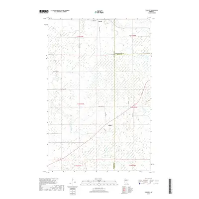
2019 Map of Funkley
USGS Topo · Published 2019About this map
Funkley and Shooks anchor this northern Minnesota landscape, where the northern and southern branches of the Cormorant River dictate the local geography. The area is defined by its extensive wetland networks and sparse settlement, characteristic of the transition between Beltrami and Koochiching counties. Historic land use is evidenced by the grid of rural roads like Frenzel Rd NE and Maesse School Rd NE, which provide access to family-named landmarks and the local burial grounds at Saint Joseph Cem near the northern boundary. The drainage of N Cormorant River and S Cormorant River, alongside smaller tributaries like Perry Cr and Fish Cr, reflects the persistent importance of the watershed in this timber and peatland region.
Find a feature on this map
25 named features on this map. Tap any name to fly to it.
Don’t see what you’re looking for? This feature index may not catch every label — zoom into the map to look around manually.
Map Details
Editions of this 2019 Funkley Map
This is the sole edition of this map. No revisions or reprints were ever made.
Other maps of this area

1919 · Rosy
USGS Topo · 1:62,500

1919 · Quiring
USGS Topo · 1:62,500

1919 · Bridgie
USGS Topo · 1:62,500

1924 · Bridgie
USGS Topo · 1:62,500

1954 · Bemidji
USGS Topo · 1:250,000

1957 · Bemidji
USGS Topo · 1:250,000

1958 · Bemidji
USGS Topo · 1:250,000

1971 · Funkley
USGS Topo · 1:24,000

1971 · Decker Lake
USGS Topo · 1:24,000
1971 · Kelliher
USGS Topo · 1:24,000