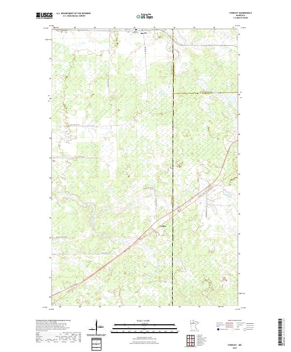
2022 Map of Funkley
USGS Topo · Published 2022About this map
The settlement of Funkley sits at the heart of this Northwoods landscape, where the Blue Ox State Trail follows a clear linear corridor through the marshy terrain of the upper Mississippi River basin. This area is characterized by a dense network of wetlands and wandering watercourses, including the North Cormorant River and South Cormorant River. Further north, the community of Shooks is situated near the Saint Joseph Cemetery, serving as a local landmark in this sparsely populated region.
Find a feature on this map
30 named features on this map. Tap any name to fly to it.
Don’t see what you’re looking for? This feature index may not catch every label — zoom into the map to look around manually.
Map Details
Editions of this 2022 Funkley Map
This is the sole edition of this map. No revisions or reprints were ever made.
Other maps of this area

1919 · Rosy
USGS Topo · 1:62,500

1919 · Quiring
USGS Topo · 1:62,500

1919 · Bridgie
USGS Topo · 1:62,500

1924 · Bridgie
USGS Topo · 1:62,500

1954 · Bemidji
USGS Topo · 1:250,000

1957 · Bemidji
USGS Topo · 1:250,000

1958 · Bemidji
USGS Topo · 1:250,000

1971 · Funkley
USGS Topo · 1:24,000

1971 · Decker Lake
USGS Topo · 1:24,000
1971 · Kelliher
USGS Topo · 1:24,000