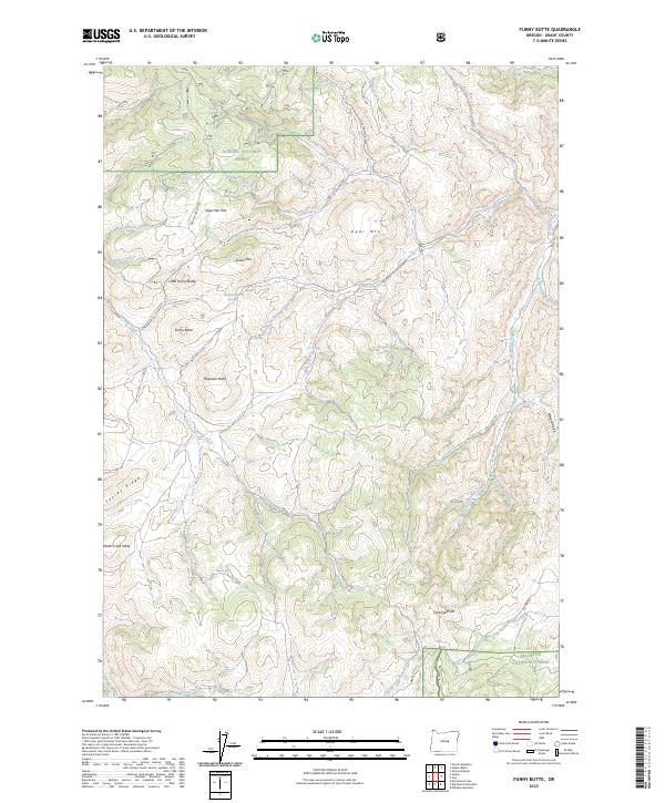
2023 Map of Funny Butte
USGS Topo · Published 2023About this map
Ochoco National Forest and Malheur National Forest converge in this high-elevation reach of Grant County, where the landscape is defined by volcanic features and a network of named springs. Central to this survey are the namesake Funny Butte and its neighbor, Little Funny Butte, rising above Sage Hen Flat. The geography reveals a transition between prominent ridges like Souley Ridge and flat-topped formations such as Moon Creek Table. Water remains a critical element for local land use, evidenced by named water sources including Frankies Cabin Spring, Thursday Spring, and Bull Creek Spring. Remote access is maintained through a series of National Forest Development Roads and the Izee Ranch-to Co Line Rd, illustrating the region's enduring connection to timber and ranching activities. The drainage patterns of Wilson Creek, Jackass Creek, and Brisbois Creek carve through the terrain, leading toward larger systems beyond the forested boundaries.
Find a feature on this map
43 named features on this map. Tap any name to fly to it.
Don’t see what you’re looking for? This feature index may not catch every label — zoom into the map to look around manually.
Map Details
Editions of this 2023 Funny Butte Map
This is the sole edition of this map. No revisions or reprints were ever made.
Other maps of this area

1932 · Dayville
USGS Topo · 1:125,000

1936 · Dayville
USGS Topo · 1:125,000

1955 · Burns
USGS Topo · 1:250,000

1955 · Canyon City
USGS Topo · 1:250,000

1958 · Burns
USGS Topo · 1:250,000

1959 · Burns
USGS Topo · 1:250,000

1959 · Canyon City
USGS Topo · 1:250,000

1959 · Sawtooth Creek
USGS Topo · 1:62,500

1961 · Delintment Lake
USGS Topo · 1:62,500

1961 · Izee
USGS Topo · 1:62,500