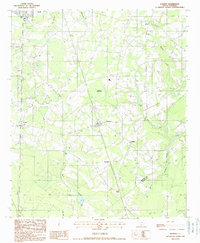
1988 Map of Furman
USGS Topo · Published 1988About this map
Furman serves as the central hub for this Lowcountry landscape, situated at a junction of roads and rail history in the late 1980s. The map captures the small-town footprints of Scotia, Stafford, and Estill against a backdrop of dense wetlands and winding watercourses like Black Swamp and Johns Pen Creek. An interpretive highlight is the presence of an Old Railroad Grade running through the terrain, indicating the shifting transportation infrastructure that once served this rural timber and agricultural region. Numerous Cem markers and family-named locales such as De Loach and Stokes provide valuable reference points for genealogists tracing ancestral roots in the coastal plain. The terrain is characterized by numerous small bays and branches, including Filly Branch and Hurricane Branch, which feed into the larger swamp systems that define the Hampton County and Jasper County border lands.
Find a feature on this map
20 named features on this map. Tap any name to fly to it.
Don’t see what you’re looking for? This feature index may not catch every label — zoom into the map to look around manually.
Map Details
Editions of this 1988 Furman Map
This is the sole edition of this map. No revisions or reprints were ever made.
Other maps of this area

1918 · Varnville
USGS Topo · 1:62,500

1919 · Pineland
USGS Topo · 1:62,500

1919 · Shirley
USGS Topo · 1:62,500

1920 · Peeples
USGS Topo · 1:62,500

1943 · Pineland
USGS Topo · 1:62,500

1943 · Peeples
USGS Topo · 1:62,500

1943 · Shirley
USGS Topo · 1:62,500

1944 · Varnville
USGS Topo · 1:62,500

1947 · Savannah
USGS Topo · 1:250,000

1948 · Savannah
USGS Topo · 1:250,000