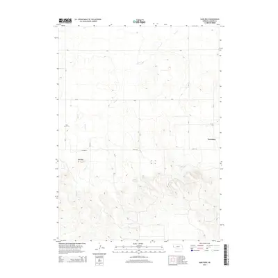
2014 Map of Gabe Rock
USGS Topo · Published 2014About this map
Harrisburg serves as the primary settlement within this section of Banner County, situated near the intersection of several rural county roads. The landscape is defined by the drainage of Willow Cr, which winds through the high plains terrain, and the eponymous Gabe Rock formation. Local history and genealogy interest is centered on the Gabe Rock Cem, located west of the main creek. Water management in this arid region is evidenced by the presence of the Anderson Reservoir and the Cross Group Reservoir in the southern half of the map. The rectangular grid of the Public Land Survey System is clearly visible through the road network, including thoroughfares such as Canyon Rd and several numbered county routes that provide access to the surrounding ranching and agricultural land.
Find a feature on this map
17 named features on this map. Tap any name to fly to it.
Don’t see what you’re looking for? This feature index may not catch every label — zoom into the map to look around manually.
Map Details
Editions of this 2014 Gabe Rock Map
This is the sole edition of this map. No revisions or reprints were ever made.
Other maps of this area

1898 · Scotts Bluff
USGS Topo · 1:125,000

1954 · Scottsbluff
USGS Topo · 1:250,000

1958 · Scottsbluff
USGS Topo · 1:250,000

1960 · Murray Lake
USGS Topo · 1:24,000

1973 · Scotts Bluff 4 NW
USGS Topo · 1:24,000

1973 · Kimball 2 NE
USGS Topo · 1:24,000

1973 · Scotts Bluff 4 SW
USGS Topo · 1:24,000

1973 · Scotts Bluff 3 SE
USGS Topo · 1:24,000
1973 · Kimball 2 NW
USGS Topo · 1:24,000

1973 · Kimball 1 NW
USGS Topo · 1:24,000