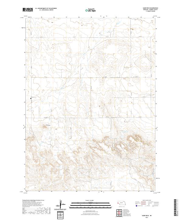
2021 Map of Gabe Rock
USGS Topo · Published 2021About this map
Gabe Rock rises as a prominent landmark in this corner of Banner County, presiding over a landscape defined by deep drainages and high plains ranching. The presence of the Gabe Rock Cem indicates the long-standing settlement of this high-altitude prairie, where the Willow Cr watershed carves through the terrain. The map reveals the intricate network of section-line roads, including Co Rd 32 and Co Rd 28, that cross the township lines of t19n r57w and t19n r56w. To the southeast, the Cross Group Reservoir provides a critical water source for the region's agricultural activities. This survey provides a modern view of the enduring geographic patterns in a remote part of western Nebraska, where names like Canyon Rd reflect the local topography.
Find a feature on this map
21 named features on this map. Tap any name to fly to it.
Don’t see what you’re looking for? This feature index may not catch every label — zoom into the map to look around manually.
Map Details
Editions of this 2021 Gabe Rock Map
This is the sole edition of this map. No revisions or reprints were ever made.
Other maps of this area

1898 · Scotts Bluff
USGS Topo · 1:125,000

1954 · Scottsbluff
USGS Topo · 1:250,000

1958 · Scottsbluff
USGS Topo · 1:250,000

1960 · Murray Lake
USGS Topo · 1:24,000

1973 · Scotts Bluff 4 NW
USGS Topo · 1:24,000

1973 · Kimball 2 NE
USGS Topo · 1:24,000

1973 · Scotts Bluff 4 SW
USGS Topo · 1:24,000

1973 · Scotts Bluff 3 SE
USGS Topo · 1:24,000
1973 · Kimball 2 NW
USGS Topo · 1:24,000

1973 · Kimball 1 NW
USGS Topo · 1:24,000