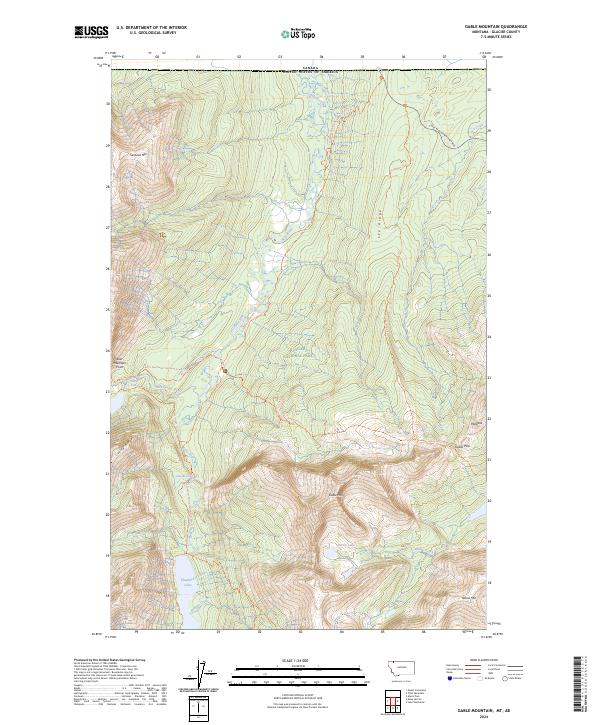
2024 Map of Gable Mountain
USGS Topo · Published 2024About this map
Glacier National Park defines the high-altitude wilderness of northern Montana, where the terrain transitions sharply from the deep valley of the Belly River to the prominent heights of Gable Mtn and Sentinel Mtn. This modern survey documents a landscape preserved for its natural character, dominated by steep ridgelines like Cosley Ridge and Lee Ridge. The area is a critical junction for long-distance travel, featuring the intersection of the Continental Divide National Scenic Trl and the Pacific Northwest National Scenic Trl. Hydrological features are abundant, from the sprawling Elizabeth Lake fed by Redgap Creek to the cascades of Dawn Mist Falls and Gros Ventre Falls. The map also captures the international border where the park meets Canada, marked by the path of the Chief Mountain Highway winding through the northeastern corner near Lee Creek.
Find a feature on this map
28 named features on this map. Tap any name to fly to it.
Don’t see what you’re looking for? This feature index may not catch every label — zoom into the map to look around manually.
Map Details
Editions of this 2024 Gable Mountain Map
This is the sole edition of this map. No revisions or reprints were ever made.
Other maps of this area

1904 · Chief Mountain
USGS Topo · 1:125,000

1938 · Chief Mountain
USGS Topo · 1:125,000

1960 · Cut Bank
USGS Topo · 1:250,000

1963 · Cut Bank
USGS Topo · 1:250,000

1964 · Cut Bank
USGS Topo · 1:250,000

1968 · Ahern Pass
USGS Topo · 1:24,000

1968 · Gable Mountain
USGS Topo · 1:24,000
1968 · Mount Cleveland
USGS Topo · 1:24,000
1968 · Chief Mountain
USGS Topo · 1:24,000
1968 · Lake Sherburne
USGS Topo · 1:24,000