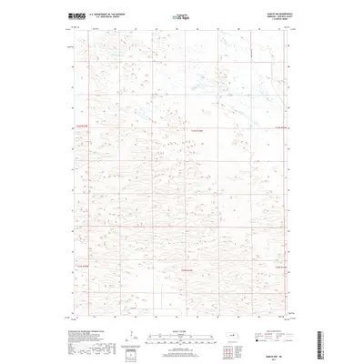
2017 Map of Gables NW
USGS Topo · Published 2017About this map
Little Cedar Cr and Big Cedar Cr wind through the northwestern corner of Garfield County, marking the subtle drainage patterns of this Nebraska landscape. The terrain is characterized by a high density of small wetlands and depressions typical of the region's sandy geography, where water movement is seasonal and localized. Transport across this sparsely populated section of the Great Plains is defined by long, straight thoroughfares including Silver Rd along the southern boundary and Cedar River Rd to the northeast. This 2017 U.S. Geological Survey topographic study illustrates the persistence of the Public Land Survey System, with township lines such as t23n r14w and t22n r14w providing the primary spatial framework for ranching and land management in the absence of dense town sites.
Find a feature on this map
11 named features on this map. Tap any name to fly to it.
Don’t see what you’re looking for? This feature index may not catch every label — zoom into the map to look around manually.
Map Details
Editions of this 2017 Gables NW Map
This is the sole edition of this map. No revisions or reprints were ever made.
Other maps of this area

1952 · Burwell SE
USGS Topo · 1:24,000

1952 · Burwell NE
USGS Topo · 1:24,000

1954 · Gables SE
USGS Topo · 1:24,000

1954 · Gables SW
USGS Topo · 1:24,000

1954 · Gables NW
USGS Topo · 1:24,000

1954 · Gables
USGS Topo · 1:24,000

1955 · Broken Bow
USGS Topo · 1:250,000

1955 · O'Neill
USGS Topo · 1:250,000

1956 · Broken Bow
USGS Topo · 1:250,000

1959 · O'Neill
USGS Topo · 1:250,000