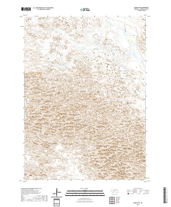
2021 Map of Gables NW
USGS Topo · Published 2021About this map
Big Cedar Cr and Little Cedar Cr flow through this section of Garfield County, marking a landscape defined by the intricate hydrology of the Sandhills. The terrain is characterized by numerous small depressions and basins, a pattern typical of this Nebraska region where surface water and groundwater are closely linked. While formal settlements are absent, the map traces the essential rural infrastructure that connects this cattle country, including Silver Rd and the Cedar River Rd which follows the path of the watercourses in the northeastern corner. The inclusion of the Public Land Survey System grids, such as t23n r14w, illustrates the orderly division of this open range into townships and ranges, a foundational element for land ownership and genealogical research in the Great Plains.
Find a feature on this map
11 named features on this map. Tap any name to fly to it.
Don’t see what you’re looking for? This feature index may not catch every label — zoom into the map to look around manually.
Map Details
Editions of this 2021 Gables NW Map
This is the sole edition of this map. No revisions or reprints were ever made.
Other maps of this area

1952 · Burwell SE
USGS Topo · 1:24,000

1952 · Burwell NE
USGS Topo · 1:24,000

1954 · Gables SE
USGS Topo · 1:24,000

1954 · Gables SW
USGS Topo · 1:24,000

1954 · Gables NW
USGS Topo · 1:24,000

1954 · Gables
USGS Topo · 1:24,000

1955 · Broken Bow
USGS Topo · 1:250,000

1955 · O'Neill
USGS Topo · 1:250,000

1956 · Broken Bow
USGS Topo · 1:250,000

1959 · O'Neill
USGS Topo · 1:250,000