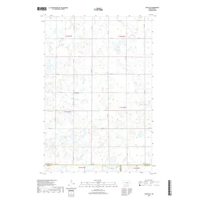
2018 Map of Gackle NE
USGS Topo · Published 2018About this map
Buffalo Creek meanders through the central and southeastern plains of this landscape, carving a subtle path through a region defined by its numerous small wetlands and prairie potholes. This rural North Dakota terrain reflects the systematic organization of the Public Land Survey System, with a rigid grid of section-line roads including 54th St SE and 47th St SE providing the primary transit network. For genealogists and local historians, the Seventh Day Adventist Cemetery stands as a focal point for the community in the northwestern portion of the map. The map captures the meeting of three counties—Stutsman, Logan, and LaMoure—illustrating how administrative boundaries intersect within this sparsely populated agricultural area in the late 2010s.
Find a feature on this map
17 named features on this map. Tap any name to fly to it.
Don’t see what you’re looking for? This feature index may not catch every label — zoom into the map to look around manually.
Map Details
Editions of this 2018 Gackle NE Map
This is the sole edition of this map. No revisions or reprints were ever made.
Other maps of this area

1896 · Jamestown
USGS Topo · 1:125,000

1952 · Jud NW
USGS Topo · 1:24,000

1952 · Eldridge SW
USGS Topo · 1:24,000

1953 · Jamestown
USGS Topo · 1:250,000

1953 · Cleveland SE
USGS Topo · 1:24,000

1953 · Jud
USGS Topo · 1:24,000

1953 · Cleveland SW
USGS Topo · 1:24,000

1956 · Jamestown
USGS Topo · 1:250,000

1983 · Alfred
USGS Topo · 1:24,000

1983 · Gackle North
USGS Topo · 1:24,000