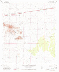
1963 Map of Gage
USGS Topo · Published 1980About this map
The high desert plains of Luna County are anchored by the Gage settlement, located along the vital transportation corridor of the Southern Pacific railroad and Interstate 10. This arid landscape is defined by its water infrastructure, with numerous family and place-named wells and windmills like Airington Windmill and Berts Well providing the lifeblood for isolated outposts such as the Earp Ranch. The stark rises of the Victorio Mountains dominate the western portion of the sheet, while drainage patterns like Cow Springs Draw and Seventysix Draw carve subtle paths through the terrain.
Find a feature on this map
20 named features on this map. Tap any name to fly to it.
Don’t see what you’re looking for? This feature index may not catch every label — zoom into the map to look around manually.
Map Details
Editions of this 1963 Gage Map
2 editions found
Other maps of this area

1899 · Deming
USGS Topo · 1:125,000

1915 · Deming
USGS Topo · 1:125,000

1954 · Silver City
USGS Topo · 1:250,000

1955 · Las Cruces
USGS Topo · 1:250,000

1958 · Las Cruces
USGS Topo · 1:250,000

1958 · Silver City
USGS Topo · 1:250,000

1962 · Silver City
USGS Topo · 1:250,000

1963 · Gage SW
USGS Topo · 1:24,000

1963 · Gage NW
USGS Topo · 1:24,000

1963 · Gage
USGS Topo · 1:24,000