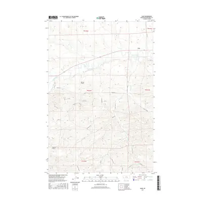
2017 Map of Gage
USGS Topo · Published 2017About this map
The Musselshell River winds through this central Montana landscape, defining the character of the valley near the settlement of Gage. Irrigation remains a vital component of the local geography, evidenced by the N-F Ditch running parallel to the river and the presence of Willow Cr. The terrain is marked by deep drainage features like Barrigan Coulee and Deadman Coulee, which cut through the high ground rising away from the river banks.
Find a feature on this map
37 named features on this map. Tap any name to fly to it.
Don’t see what you’re looking for? This feature index may not catch every label — zoom into the map to look around manually.
Map Details
Editions of this 2017 Gage Map
This is the sole edition of this map. No revisions or reprints were ever made.
Other maps of this area

1954 · Roundup
USGS Topo · 1:250,000

1958 · Roundup
USGS Topo · 1:250,000

1979 · Roundup
USGS Topo · 1:100,000

1979 · Gage NE
USGS Topo · 1:24,000

1979 · Harper Coulee
USGS Topo · 1:24,000

1979 · Gage
USGS Topo · 1:24,000

1979 · Roundup
USGS Topo · 1:24,000

1980 · Dunn Mountain North
USGS Topo · 1:24,000

1980 · Signal Mountain
USGS Topo · 1:24,000

1986 · Lake Mason SE
USGS Topo · 1:24,000